A crucial aspect of this event: finding your way from one transition point to the next, on time! Due to limited parking space, there is a limit of one vehicle per team at each transition. Drive over the course and plan your strategy in advance. A good map of the area is indispensable. With the aid of a map, the following instructions may be of assistance...
Start and Transition One - Kalkite Waters
Google pin – https://maps.app.goo.gl/S7e5ncrsn62SdRDu9
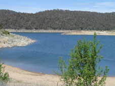
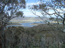
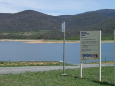 The start of the Sri Chinmoy Multi-Sport Classic is in one of the prettiest corners on the lake.
Driving instructions to Kalkite Waters (allow 30 minutes from Jindabyne)
From Kosciuszko Rd (the Berridale - Jindabyne road) turn RIGHT if you are coming from Berridale, or LEFT if you are coming from Jindabyne, onto Eucumbene Rd (this turn-off is about 14 kms from Jindabyne). After a little over 2 kms, turn LEFT into the Kalkite Rd.
Enjoy stunning views of the lake and surrounds as you descend. Drive past Kalkite Village and continue another 2.3 kms along the dirt road. Look for the turn-off into the picnic area and boat ramp on your LEFT.
Park anywhere above and away from the boat ramp area. This is the START of the race and transition from Swim 1 to Paddle 1.
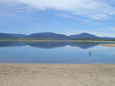
Transition Two - Rushes Bay, East Jindabyne
 Google pin – https://maps.app.goo.gl/HmgXiffyUVQmfkza7
From the remote outpost of Kalkite, the race moves into the more inhabited southern half of Lake Jindabyne, making landfall at pretty Rushes Bay.
Driving Instructions from Kalkite Waters to Rushes Bay beach, East Jindabyne (allow 25 minutes)
Return along Kalkite Rd past Kalkite and up the hill. Turn RIGHT onto Eucumbene Rd, then RIGHT again onto Kosciuszko Rd heading towards Jindabyne. Pass the hotel and service station at the top of the hill. Turn RIGHT at the signs to East Jindabyne, into Jerrara Dr. Once in East Jindabyne, turn LEFT into Boronga St. At the end of Boronga St, turn LEFT again and continue on this dirt road all the way to the beach at Rushes Bay. Be careful of the runners, as this section of dirt road is part of the running course for leg 3. Park anywhere along here, away from the road, or on the beach itself behind the willows. This is the transition from Paddle 1 to Run 1.
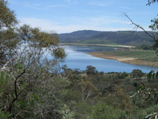
Transition Three and Four - South Tyrolean Cove
 Google pin – https://maps.app.goo.gl/WEUJoQRNLZqFWCRM9
The hub of the next few legs is a vacant lot and an isolated little beach just south of Tyrolean Village. Parking is along Rainbow Dr and Echidna Place.
Driving Instructions from Rushes Bay beach to South Tyrolean Cove (allow 10 minutes driving, plus another 5 minutes walking to the transition.)
 Return along the same dirt road that brought you to Rushes Bay, back to Boronga St and then RIGHT into Jerrara Dr. Turn RIGHT at Kosciuszko Rd. After less than 2 kms, turn RIGHT again into Rainbow Dr, towards Tyrolean Village. Drive slowly down the hill. About 1 km down this road just before you come to the village, park along the side of the road. The transition from Run 1 to MTB 1 is just of Echidna Pl, which leads off Rainbow Dr to the left.
This is the transition from the 1st run to the 1st mountain bike. The transition from the 1st mountain bike to the 2nd swim, is about 400 metres down a 4WD track leading south from this space, at South Tyrolean Cove.
Transition Five - The Haven
 Google pin – https://maps.app.goo.gl/qQ64SUBjeuM3wYae7
The Haven (formerly known as Stinky Bay), on the southern edge of Jindabyne town, is a delightful haven for swimming, boating and imbibing the beauty and serenity of Nature.
Driving Instructions from South Tyrolean Inlet to The Haven (AKA Stinky Bay) (allow 15 minutes.)
Return along Rainbow Dr up to Kosciuszko Rd. Turn RIGHT towards Jindabyne. The entire first mountain bike course is through the bushland on your right. NOTE that there is construction work currently under way on the modifications to Jindabyne Dam. This may cause hold-ups of up to 10 minutes, so do not delay in leaving for the next transition! Cross over the dam wall and into Jindabyne. Take the first RIGHT into Banjo Patterson Cres, then the next RIGHT after 60 metres onto Cobbon Cres. Follow this around to the left, sweeping above The Haven. The access to the beach is a dirt road on your RIGHT. Park anywhere along the beachfront, out of the way of the transition. This is the transition point from Swim 2 to Paddle 2.
NOTE: once your swimmer arrives, leave immediately for Hatchery Bay, as time to reach the next transition is tight!
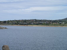
Transition Six - Wollondibby Inlet
Google pin – https://maps.app.goo.gl/k2LT1eUEVGKojGkt8
 The course arrives on land for the second time - now amidst the milder and more open terrain of the western shore.
Driving Instructions from Stinky Bay to Wollondibby Inlet (allow 15 minutes driving.)
Exit via the dirt access road from The Haven and turn RIGHT onto Cobbon Cres, then LEFT on Townsend St and immediately RIGHT onto Banjo Patterson Cres. Then turn RIGHT at Kosciuszko Rd. Follow this through and out of town.
About 1.5 kms past the Alpine Way (to Thredbo) turn-off, look for Wollondibby Inlet (unsigned) on your RIGHT. Follow this dirt road for less than one hundred metres, then park.
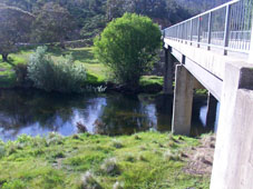
Transition Seven - Thredbo River Picnic Area
The course now leaves the lake and heads for the hills, literally.
Driving Directions from Wollondibby Inlet to Thredbo River Picnic Area (allow 10 minutes.)
Drive back to the main road , then turn RIGHT onto Kosciuszko Rd. After about 3 kms, immediately after crossing the Thredbo River, turn left into the Thredbo River Picnic Area.
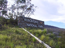
NOTE: This is the last transition before entering Kosciuszko National Park. The next two transitions are within the Park, for which you will need your kayak, your mountain bike and a swimmer (your runner enters the Park on foot). Entry to the Park is $16 per car.
Transition Eight - Kosciuszko National Park Education Centre at Sawpit Creek
 Google pin – https://maps.app.goo.gl/UmfmjCyCw6sL3sg97
An ideal opportunity for those awaiting their runner to appreciate some of the beauty and tranquility of the mighty Kosciuszko National Park.
Driving Instructions from Thredbo River Picnic Area to the Kosciuszko National Park Education Centre, Sawpit Creek on Kosciuszko Rd (allow 15 minutes.)
 From the transition of Mountain Bike 2 to Run 2, return to Kosciuszko Rd where you turn LEFT, and immediately enter the Kosciuszko National Park.
Continue up the hill past the surge tower. Look for the Kosciuszko Education Centre and Sawpit Creek on your left. Park here. The transition from Run 2 to Mountain Bike 3 will take place here.
Transition Nine and Ten - Creel Bay
 Googel pin – https://maps.app.goo.gl/i3Tp97rJ1UGJYDgW6
Here we say goodbye to Kosciuszko National Park, and prepare for the final charge home.
Driving Instructions from Kosciuszko National Park Education Centre, Sawpit Creek to Creel Bay (allow 15 minutes.)
NOTE: From Sawpit Creek, we ask you please in the interest of safety, NOT to drive west along Kosciuszko Rd following the cyclists.
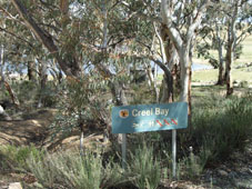 Instead, please turn onto Kosciuszko Rd heading back towards Jindabyne. Pass the surge tower on your left, and after about 1 km look for the turn-off to Waste Point. Turn LEFT down this road, and continue straight all the way. After the Pumping Station turn-off, be very aware that you are now on the cycle course. Watch out for cyclists! The road turns to dirt, and arrives at the Creel Bay boat ramp.
Park away from the boat ramp, towards the toilet block or along the road heading back uphill. Swimmers will be ferried from here to their starting point at Horseshoe Bay, and cyclists will be ferried from Horseshoe Bay back to here. This is the transition point from Swim 3 to Paddle 3.
Transition Eleven - Wollondibby Inlet
Google pin – https://maps.app.goo.gl/k2LT1eUEVGKojGkt8
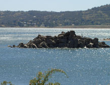
The final transition is in a lovely little inlet guarded by the imposing "Curiosity Rocks" (pictured).
Driving Instructions from Creel Bay to Wollondibby Inlet (allow 10 minutes.)
Return along Waste Point Rd to the top of the hill, turning LEFT onto Kosciuszko Rd, towards Jindabyne. After the Hatchery Bay turn-off, you will cross over Wollondibby Creek. Exactly 1 km after Wollondibby Creek, look for a dirt road turn-off on your LEFT, right next to a large pine tree. This is Wollondibby Inlet. The transition from Paddle 3 to Run 3 is by the water's edge.
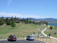
Finish - Banjo Patterson Park
 Google pin – https://maps.app.goo.gl/atSLD4nj95zzy2nWA
The trim lawns of Banjo Patterson Park welcome the adventurers to relax and savour their victory.
Driving Instructions from Wollondibby Inlet to Banjo Patterson Park (allow 10 minutes.)
Return to the main road (Kosciuszko Rd) and turn LEFT back into town. Pass through two roundabouts, and at Bay St turn LEFT and park adjacent to Banjo Patterson Park. There is overflow parking in the car park for the Jindabyne Bowling and Sports Club, or at the shops across the road.
Banjo Patterson Park is the finish line.