
AustraliaSri Chinmoy Marathon Team

  • About us
  • Our races
  • Results

Search form

Founded by Sri Chinmoy in 1977, the Marathon Team is one of the world's largest organisers of endurance events.
read more »

Gallery

Thousands of event images

History

From 2 to 3100 miles

Sri Chinmoy

Marathon Team Founder

Next Event:

7 June - Sydney
Sri Chinmoy Sydney Series
Details »

More events:

Brisbane
Canberra
Jindabyne
Melbourne
Sydney
View all events »

Worldwide:

View full list »

Latest results:

1 June - Canberra
Sri Chinmoy Canberra Trail Series 3: "Red Hill Ramble" 12.8km, 8km & 2.4km trail runs, Monday 1 June 2026
Details »

Previous races

View all results »

Worldwide results

Full list »

Sri Chinmoy Labour Day 10 km & 4 km Fun-Run 5 October 2009 Results

By Prachar Stegemann
5 October

Download 10 km Race results by category

Download 4 km Race results by category

Sri Chinmoy Marathon Team articles - more articles

Leg 11 - Paddle 9.5 km

By Prachar Stegemann
12 March

Ther 3rd paddle is the longest of the three, and coming later in the day can be the most testing if the wind has picked up. Note that paddlers MUST carry their own water or other replacement fluid. It is compulsory for paddlers to wear a PFD.

View and download this course on Garmin Connect.

Paddle to the east from the beach at Creel Bay. When after 2 kms you find a red marker buoy, turn around this to your right. Shortly, you will reach the main body of the lake. Head south towards Jindabyne.
After 6 kms, you will come to a black marker buoy: keep this buoy to your right. You are heading towards the hilltops to the right of Jindabyne. Glide past Hatchery Bay, and aim for the outcrop of land to the right of Lion Island, with trees on it. This is the southern end of the tip of Wollondibby Inlet.

Here turn right when you are close enough, and head for Curiosity Rocks. Passing through Curiosity Rocks you will find Wollondibby Inlet and the change-over point to the final leg of the day.

sri_chinmoy_multisport_classic_leg11

For detailed course descriptions and maps of other legs, select from the list below.
 

Leg 1 Swim 1.5 km Course Description
Leg 2 Paddle 9 km Course Description
Leg 3 Run 6 km Course Description
Leg 4 Mountain Bike 8 km Course Description
Leg 5 Swim 2.5 km Course Description
Leg 6 Paddle 5km Course Description
Leg 7 Mountain Bike 9 km Course Description
Leg 8 Run 12.5 km Course Description
Leg 9 Mountain Bike 42.8 km Course Description
Leg 10 Swim 1.2 km Course Description
Leg 12 Run 5 km Course Description


View full article »

Leg 2 – 38km Mountain Bike

By Prachar Stegemann
14 November

View and download the full course on Garmin Connect, or download the gpx file. Enjoy a GoPro tour of the entire course as ridden by Andrew Oberg.

Follow the cycle path north, then almost immediately taking a left-hand fork (do NOT go under the bridge) to bring you onto the Ginninderra Dr bridge crossing the lake. Continue following the cycle path around the shoreline.  Just after John Knight Memorial Park, turn left at a fork in the cycle path, travelling under Aikman Drive and into the University of Canberra.

Follow the pathways through the University, crossing over College St at the pedestrian traffic lights.  After crossing College St, follow the bike path beside Haydon Dr. Cross over Battye St, before turning right to climb over the wooden access gate into the Nature Reserve on Gossan Hill.

Follow the fire road with a fence on your right for a few hundred metres. Head uphill to the left at a fork in the road. Turn right at the next crossroads. Take the left of the two 'straight ahead' options at the 5-way intersection when you reach the top of the crest.  You are now heading along the crest of Gossan Hill, through eucalyptus forest. Veer right at the fork in this track, then left onto the bitumen road (thus avoiding the deep kerb), and left again off this road onto the footpath leading towards the Belconnen Way overpass.

Across the overpass, follow the cycle path through the Aranda District Playing Fields. Go under Bandjalong Cres, straight up past the Aranda shops on your left and uphill on the concrete path. Cross over Walu St, and after a brief dirt section rejoin the footpath, still heading up. At the top, go through the walkers' gap in the fence, then immediately left. 

With Telstra Tower and Black Mountain looming straight ahead, the track dips. Take the first available sharp right, immediately before the power lines.  Follow this track in line with the power lines  through a dog-leg left-right, down a long hill.  Turn left onto another track at the bottom of the descent, immediately after a large power line pylon.  Follow this track around the base of Aranda Hill as far as it goes, eventually turning to your right onto the road at the base of the Gungahlin Drive Extension, leading up to the underpass under the GDE.  Pass under the road.

You are now in Black Mountain Reserve. Take the first right hand fork in the track. There are no turns for a few kilometres as you enjoy a pleasant ride around the base of Black Mountain, through natural gum forest and open spaces. At the end of this section, veer left back into the bush, heading uphill. Go right at the T-junction, down a sharp rocky slope and through a dry creek bed. Upon rising out of the creek bed, the track swings to the left and you are confronted with the infamous, though now graded "Push-Bike Hill." ...

Just before the gate at the top, take a tiny trail veering to the left, which leads out onto the road without having to climb a gate. Be alert for traffic, as you turn left (uphill), and follow the road to the summit of Black Mountain, where the road loops around before descending. There is an aid station at the top.

On the way down, continue on the road past the picnic ground car park, then about 500 metres later, turn left  opposite the water reservoir on your right onto another 4WD track, heading once more downhill. This track winds around the flank of the mountain, and after a few gradual rises and a descent comes to a metal gate with a walkers' entrance beside it.

Passing through this entrance, follow the track to the left before turning right onto a large dirt road (Frith Road) which you follow downhill for approx. 300m before turning left to pass through another walkers' gate and follow the dirt road that climbs up next to the electricity substation. Just after the substation take care to veer off the road to the right to follow the embankment and follow the Canberra Centenary Trail (CCT) single track, that runs under the powerlines. After approx 300m the CCT drops off the embankment to the right to descend to Frith Rd. Cross straight across the road, and then turn left to head through the Barry Dr. underpass on the LHS. After exiting the tunnel turn hard left at the CCT/Stop sign to take a single track heading uphill into the trees. Follow the CCT track all the way through to the roundabout at Fairfax St/Dryandra St Belconnen Way. Follow the Course Marshal's instructions to cross the road.

Enter the Bruce Ridge reserve through the gap in the fence on the corner of Fairfax St and Dryandra St. Follow the obvious single track here (Box Gum Margin). Turn left onto the Heath Run, into Belco Switchbacks. Follow this into the Burin single track. Turn right onto Happy Wanderer, then left at Northface (via a link trail). Veer right at Commuted and follow it to where it joins a track under the powerlines. Turn left onto this track, which leads down to a wooden gate in the fence. Pass to the left of the gate, cross over the cycle path, pass between some boulders by a metal gate, then follow the track that veers up to the right.

At the top of the rise, swing to the left along O'Connor Ridge, then turn right at the next small signpost onto a "Multiple Use Track". This smaller track brings you around the side of O'Connor Ridge, then along the top of a small levee, eventually veering to the right, leading you to a gate. Climb the gate, and head left onto Dryandra St, which then turns right and becomes Archibald St. Pass the Ukrainian Catholic Centre, Ursula College Lyneham Centre, St Joseph's House of Studies, and the Sakyamuni Buddhist Centre. Turn left onto the footpath leading alongside the Buddhist Centre, which overpasses Ginninderra Dr and brings you into North Lyneham.

After the overpass, turn immediately left into Cossington Smith Cres, then left again into Fred Williams Cres, left into Duterrau Cres, and left into Lewers Close. Continue straight onto the track at the end of Lewers Close, which climbs and then flattens out. Look for a small gap in the fence on your right. Go through here, then turn left onto a main dirt track. This track first heads down, then veers twice to the right while climbing, then once to the left before starting to descend.

Turn left at the next T-junction, then right again after 20 metres. When this track comes to a gateless gate, turn to your left. Veer slightly to the right and cross the horse logs. As you follow the trail out of the trees, turn right, heading towards Ellenborough St. Turn right onto the Kaleen cycle path. After a short distance, turn left, at the new cycle path crossing. After crossing Ellenborough St, turn right, following the cycle path. Turn left at the next junction. Continue along this cycle path under the Barton Highway, and parallel with the highway on the other side.

At the Gungahlin Dr fly-over, this cycle path follows Gungahlin Dr around to the right. Follow this cycle path all the way to Sanford St, turning right.

Continue to Hoskins St and turn right. Continue south towards Bellenden St (the old course, now heavily fenced). Continue south at this junction passing the Community Garden. At the end of this road, turn left onto the equestrian trail, alongside a stand of gum trees. This section is notoriously muddy after rain. Follow the equestrian trail to the end, then turn right onto a bitumen service road. Follow this road to Randwick Rd. Turn left onto Randwick Rd.

Cross over Flemington Rd, then follow the cycle path to the right, past EPIC on your left. Cross over the Federal Hwy at the lights. Go straight ahead on the other side of the highway, then turn left onto the narrow dirt track beside the line of trees.  Veer to the right as you approach Stirling Ave. Cross over Knox St at the junction of Stirling Ave, straight through the gap next to the gate. After 50m, take the trail to the left, then veer right and follow this track onto the dirt road. Note that this area is a popular area for dog-walking and off-leash dogs – PLEASE look out for pedestrians walking their dogs and for off-leash dogs and give them right of way at all times. Finish at the bus stop on Antill St.

mtb-1-profile.png


<Previous | Next>                             Back to Contents

View full article »

Leg 5 – 38km Mountain Bike

By Prachar Stegemann
10 November

View and download the full course on Garmin Connect, or download the gpx file. Enjoy a GoPro tour of the entire course, as ridden by Andrew Öberg in 2025.

The second mountain bike ride starts at Henry Rolland Park, off Barrine Dr, Acton and follows the cycle path west. Continue on this path straight across Acton Peninsula and Black Mountain Peninsula.

At Acacia Inlet (after the rowing jetty), turn right onto the cycle path leading to Belconnen, across Lady Denman Dr (watch for traffic) and underneath Parkes Way and Caswell Dr. 
Turn left off the cycle path onto the equestrian trail under William Hovell Dr, through the gate on the left with the sign, ‘Stock Grazing Within’ (be sure to close this gate again!), and along the trail to the left, alongside the Cork Oak Plantation.

After the Cork Oaks, you will arrive at the National Arboretum carpark. Turn immediately to your right, up Gunbarrel Hill and follow this outer perimeter road (Boundary Rd), past the main Arboretum car parks. You will end up at the bottom of an incline, at a five-way intersection. Cross the new road and over a gate and continue on this diagonal direction, past a little water tank (on your right). You will eventually come to a four way intersection, veer left here and continue slightly uphill. After going under the powerlines, continue for approx 1.5km where you will turn right on a lesser track taking you back under the powerlines, turn right soon after, taking you to a gate leading to Pipe Flat.
 
Follow this road for about 3 kms alongside Molonglo River until the next gate, bringing you to Coppins Crossing Road. There are some works in progress just before Coppins Crossing Road, so you may need to climb an additional gate here. THIS ROAD IS NOW MUCH BUSIER THAN IN PREVIOUS YEARS – TAKE GREAT CARE AS YOU CROSS DIRECTLY OVER THE ROAD LEADING TO A DIRT ROAD ON THE OTHER SIDE.
 
Continue straight ahead, veering to the left towards Butters Bridge. After crossing Butters Bridge, turn right onto the gravel path. Soon after, at the 4-way intersection, continue straight ahead down the incline, looking out for a gate on your left. Climb this gate and follow this track uphill until you return to the 2024 course, towards Denman Prospect.

Stay on this trail that runs parallel to Holborow Ave. Head towards the bridge and go under it and veer around to the left, passing by a play area on your right (no need to cross the road anymore, but be careful as children may be about). Turn left after the play area and go over the bridge. Take the first left after crossing the bridge. Head south, then turn right after approximately 200 metres, this will put you on the same trail as last year, heading up an incline. This trail now ends near the top, at a locked gate. To continue, simply turn right halfway up (about 300 metres from the last turn). Now take the next left and head along the side of Bluetts Hill. After about 550 metres of climbing, turn right, then left soon after, which will bring you back to the usual gate at Uriarra Rd.

Cross over and go right for about 50 metres, then left through the gate on the other side, into the Mt Stromlo precinct.
 
After crossing Uriarra Rd, follow the North South Link Fire Trail uphill until you reach a T-junction with Forrest Trail. Turn right here, heading now down a little, then starting to rise again until you reach a 4-way intersection where you turn left, then almost immediately right, dipping slightly then heading up onto the shoulder of the mountain. This trail flattens and follows the contour around the western side of the mountain before starting to rise again. At a fork in the trail, turn left to head sharply uphill towards the magnificent summit. At the crest of this steep climb, round a white metal gate and continue straight onto the bitumen road, past some observatory buildings on your right. Now join the main Mt Stromlo Rd and pass by the main observatory settlement. Look out for a hairpin left hand turn off the bitumen, back onto a descending fire trail. This in turn takes a hairpin right hand turn to descend further, past the Blue Gums on your left. After a short rise, take the LEFT hand fork on ‘Ridge Trail’ and continue downhill for approx. 340m before turning left at a sweeping left hand bend on the main road. Continue down this road for approx. 420m, till you reach a spacious 4-way intersection. Turn right here, heading slightly down, until you reach the bitumen road – LOOK OUT FOR THE SHUTTLE BUS AND IF IT APPEARS, PLEASE GIVE WAY! – Then, continue straight across onto the cycle path. Follow the cycle path towards and past the ACT Bushfire memorial turning right just near the entrance to the memorial and onto a small gravel path. Turn left soon after on the second single track to your left, which will take you to Cotter Rd.Cross Cotter Rd, GIVING WAY to ALL TRAFFIC, heading for the grassed right-hand side of Eucumbene Dr, where the single track can be found, to follow the right hand side of Eucumbene Dr.

Look for a right hand turn through the stile to join the track heading to the left up Narrabundah Hill. Take the first fork to your right, pass through or climb the gate on the way up, then take the next fork to your left, heading up. After passing the trig point on your right, continue straight down a long hill, ignoring the potential turn-off to your right, but going straight over another gate. Turn left onto a single track about two thirds of the way down this hill. This track will bring you around beside the large water storage tank. Continue straight ahead, through the stile gap, and right again adjacent to Eucumbene Dr. Follow this track past the end of Hindmarsh Dr, and up the other side (on a left diagonal), around the side of the new bus bay. This track (which is the Centenary Trail) veers to the left, and you continue following the fenceline around to your right, then beside Kathner St. At the intersection of Kathner St and Percy Cres, go straight onto and up the steep track leading to Cooleman Ridge.
 
Go left at the top, and proceed along Cooleman Ridge, behind Chapman. Continue all the way along Cooleman Ridge until you see a large tree at 11 o'clock. Veer left at the fork here, heading down towards the road.  Go through the gate and turn right on the cycle path.  Look out for the arrows to turn left off this cycle path, across the grass and over Namatjira Dr, taking extreme care of the 2-way traffic on this busy road, remembering that you MUST GIVE WAY TO ALL TRAFFIC.  Follow the dirt track on the other side, veering left through the gate, then ultimately turning left at the next cycle path, following this cycle path to the changeover point beside Badimara St.


mtb-2-profile.png


<Previous | Next> Back to Contents

View full article »

Sri Chinmoy Joyathon Course Description

By Prachar Stegemann
21 October


sri-chinmoy-joyathon-swim.gif
Swim - Starts on the beach at the southern end of Black Mountain Peninsula swimming area. The swim course goes around the small island, keeping the buoys to your right. Swimmers exit the water and run up the beach, following the chute under the trees to the changeover at the bike compound.


sri-chinmoy-joyathon-cycle.gif
Cycle - Starting from the Bike Compound at the southern end of John Cardiff Close, proceed north along John Cardiff Cl with a right towards Garryowen Drive, then left onto Garryowen, following it to Lady Denman Drive, where you make a left turn heading west. At the Lady Denman Dr/Forest Dr traffic lights, turn left into the Car Park Rd (no official name), proceed to the end of the car park and then continue onto the bike path leading to the main ‘’around the lake” bike path, turn left and follow the bike path initially north and then east towards Black Mountain Peninsula. Keep following the bike path till it reaches Garryowen Dr. Turn right onto the road and proceed south to John Cardiff Cl. Turn right and then left into the southern arm of John Cardiff Cl. Dismount before the entrance to the compound.


sri-chinmoy-joyathon-run.gif
Run - 2.35km
After the exiting the bike compound, the course turns left and follows the bike path around the perimeter of Black Mountain Peninsula in an anti-clockwise direction. At the northern end of the peninsula the course turns left, crosses Garryowen Drive, heads downhill on the main Lake Burley Griffin bike path and turns left again to rejoin the original bike path before completing the loop under the finish banner back at the compound.


View full article »

Sri Chinmoy Sprint Triathlon Course Description

By Prachar Stegemann
21 October


sri-chinmoy-sprint-swim.gif
Swim - Starts on the beach at the southern end of Black Mountain Peninsula swimming area. The swim course goes around the small island, keeping the buoys to your right.


sri-chinmoy-sprint-cycle_0.gif
Cycle - KEEP TO THE LEFT AND RIDE SINGLE FILE AT ALL TIMES UNLESS OVERTAKING – DRAFTING IS NOT PERMITTED.  Starting from the Bike Compound at the southern end of John Cardiff Close, proceed north along John Cardiff Cl with a right towards Garryowen Drive, then left onto Garryowen Dr, follow it to Lady Denman Drive and make a left turn heading west. At the Lady Denman Dr/Forest Dr traffic lights turn left into the Car Park Rd (no official name), do a U-turn at the end of the car park and return towards Lady Denman Dr, turn left onto lady Denman, follow to Cotter Rd. Turn left onto Cotter Rd, proceed past Dunrossil Dr and Dudley St (passing through the switched off lights controlled by SES) to merge onto Adelaide Ave. Proceed along Adelaide Ave past Hopetoun Circuit, turning left at State Circle, follow it around and then turn left at Flynn Dr. Continue down Flynn Dr towards roundabout, turn left onto Alexandrina Dr, follow till almost Hopetoun Cirt. Perform a U-turn around cones 30m before Hopetoun Cirt intersection. Return along Alexandrina Dr, at the Flynn Dr roundabout proceed straight onto Coronation Dr, turn left at Commonwealth Ave. Proceed over Commonwealth Ave bridge and take the exit ramp to turn west onto Parkes Way. Keep following Parkes Way west until the exit ramp to Lady Denman Dr. Take this exit and turn left at lights (controlled by SES) onto Lady Denman Dr and follow around to Garryowen Dr where a left turn is made and then a right turn into John Cardiff Cl. Turn left into the southern arm of John Cardiff Cl and dismount before the cycle compound.


sri-chinmoy-sprint-run_0.gif

Run - The course is an 'Out-and-Back' course. After the exiting the bike compound, the course turns right and initially follows the bike path in a northerly direction before veering left and leaving the peninsula to follow the bike path along the shore of Lake Burley Griffin in a westerly direction. The turnaround, which is at the 2.5km mark, is approximately 150 metres after passing the ACT ATSI Cultural Centre.  Return along the same route.

View full article »

Sri Chinmoy 'Classic' Tri Course Description

By Prachar Stegemann
21 October

sri-chinmoy-classic-swim.gif

Swim - Starts on the beach at the southern end of Black Mountain Peninsula swimming area. The swim course goes initially south, keeping all the buoys to your right.

sri-chinmoy-classic-cycle_0.gif

Cycle -KEEP TO THE LEFT AND RIDE SINGLE FILE AT ALL TIMES UNLESS OVERTAKING – DRAFTING IS NOT PERMITTED. Starting from the Bike Compound at the southern end of John Cardiff Close, proceed north along John Cardiff Cl with a right towards Garryowen Drive, then left onto Garryowen Dr, follow it to Lady Denman Drive and make a left turn heading west. At the Lady Denman Dr/Forest Dr traffic lights turn left into the Car Park Rd (no official name), do a U-turn at the end of the car park and return towards Lady Denman Dr, turn left onto lady Denman, follow to Cotter Rd. Turn left onto Cotter Rd, proceed past Dunrossil Dr and Dudley St (passing through the switched off lights controlled by SES) to merge onto Adelaide Ave. Proceed along Adelaide Ave past Hopetoun Circuit, turning left at State Circle, follow it around and then turn left at Flynn Dr. Continue down Flynn Dr towards roundabout, turn left onto Alexandrina Dr, follow till almost Hopetoun Cirt. Perform a U-turn around cones 30m before Hopetoun Cirt intersection. Return along Alexandrina Dr, at the Flynn Dr roundabout proceed straight onto Coronation Dr, turn left at Commonwealth Ave. Proceed over Commonwealth Ave bridge and take the exit ramp to turn west onto Parkes Way. Keep following Parkes Way west until the exit ramp to Lady Denman Dr. Take this exit and turn left at lights (controlled by SES) onto Lady Denman Dr and follow around to Garryowen Dr. Continue past the entrance to Garryowen Dr to commence a second lap of the course. After completing a second lap, turn left into Garryowen Dr and then a right turn into John Cardiff Cl. Turn left into the southern arm of John Cardiff Cl and dismount before the cycle compound.

sri-chinmoy-classic-run.gif

Run - The course is an 'Out-and-Back' course. After the exiting the bike compound, the course turns right and initially follows the bike path in a northerly direction before veering left and leaving the peninsula to follow the bike path along the shore of Lake Burley Griffin in a westerly direction. The turnaround, which is also the 5km mark, is located approximately 500 metres after the course crosses Scrivener Dam.

View full article »

Sri Chinmoy Multi-Sport Classic Transitions and Driving Directions

By Prachar Stegemann
5 March

A crucial aspect of this event: finding your way from one transition point to the next, on time! Due to limited parking space, there is a limit of one vehicle per team at each transition. Drive over the course and plan your strategy in advance. A good map of the area is indispensable. With the aid of a map, the following instructions may be of assistance...

second_run_thredbo_bridge.jpg

Directions to Kalkite Waters
Directions to Rushes Bay, East Jindabyne
Directions to South Tyrolean Cove
Directions to The Haven
Directions to Wollondibby Inlet
Directions to Thredbo River Picnic Area
Directions to Kosciuszko National Park Education Centre
Directions to Creel Bay
Directions to Wollondibby Inlet
Directions to Banjo Patterson Park


Start and Transition One - Kalkite Waters
 

Google pin – https://maps.app.goo.gl/S7e5ncrsn62SdRDu9

The start of the Sri Chinmoy Multi-Sport Classic is in one of the prettiest corners on the lake.

Driving instructions to Kalkite Waters (allow 30 minutes from Jindabyne)

From Kosciuszko Rd (the Berridale - Jindabyne road) turn RIGHT if you are coming from Berridale, or LEFT if you are coming from Jindabyne, onto Eucumbene Rd (this turn-off is about 14 kms from Jindabyne). After a little over 2 kms, turn LEFT into the Kalkite Rd.
Enjoy stunning views of the lake and surrounds as you descend. Drive past Kalkite Village and continue another 2.3 kms along the dirt road. Look for the turn-off into the picnic area and boat ramp on your LEFT.

Park anywhere above and away from the boat ramp area. This is the START of the race and transition from Swim 1 to Paddle 1.


Transition Two - Rushes Bay, East Jindabyne


Google pin – https://maps.app.goo.gl/HmgXiffyUVQmfkza7

From the remote outpost of Kalkite, the race moves into the more inhabited southern half of Lake Jindabyne, making landfall at pretty Rushes Bay.

Driving Instructions from Kalkite Waters to Rushes Bay beach, East Jindabyne (allow 25 minutes)

Return along Kalkite Rd past Kalkite and up the hill. Turn RIGHT onto Eucumbene Rd, then RIGHT again onto Kosciuszko Rd heading towards Jindabyne. Pass the hotel and service station at the top of the hill. Turn RIGHT at the signs to East Jindabyne, into Jerrara Dr. Once in East Jindabyne, turn LEFT into Boronga St. At the end of Boronga St, turn LEFT again and continue on this dirt road all the way to the beach at Rushes Bay. Be careful of the runners, as this section of dirt road is part of the running course for leg 3. Park anywhere along here, away from the road, or on the beach itself behind the willows. This is the transition from Paddle 1 to Run 1.


Transition Three and Four - South Tyrolean Cove


Google pin – https://maps.app.goo.gl/WEUJoQRNLZqFWCRM9

The hub of the next few legs is a vacant lot and an isolated little beach just south of Tyrolean Village. Parking is along Rainbow Dr and Echidna Place.

Driving Instructions from Rushes Bay beach to South Tyrolean Cove (allow 10 minutes driving, plus another 5 minutes walking to the transition.)

Return along the same dirt road that brought you to Rushes Bay, back to Boronga St and then RIGHT into Jerrara Dr. Turn RIGHT at Kosciuszko Rd. After less than 2 kms, turn RIGHT again into Rainbow Dr, towards Tyrolean Village. Drive slowly down the hill. About 1 km down this road just before you come to the village, park along the side of the road. The transition from Run 1 to MTB 1 is just of Echidna Pl, which leads off Rainbow Dr to the left.

This is the transition from the 1st run to the 1st mountain bike. The transition from the 1st mountain bike to the 2nd swim, is about 400 metres down a 4WD track leading south from this space, at South Tyrolean Cove.


Transition Five - The Haven


Google pin – https://maps.app.goo.gl/qQ64SUBjeuM3wYae7

The Haven (formerly known as Stinky Bay), on the southern edge of Jindabyne town, is a delightful haven for swimming, boating and imbibing the beauty and serenity of Nature.

Driving Instructions from South Tyrolean Inlet to The Haven (AKA Stinky Bay) (allow 15 minutes.)

Return along Rainbow Dr up to Kosciuszko Rd. Turn RIGHT towards Jindabyne. The entire first mountain bike course is through the bushland on your right. NOTE that there is construction work currently under way on the modifications to Jindabyne Dam. This may cause hold-ups of up to 10 minutes, so do not delay in leaving for the next transition! Cross over the dam wall and into Jindabyne. Take the first RIGHT into Banjo Patterson Cres, then the next RIGHT after 60 metres onto Cobbon Cres. Follow this around to the left, sweeping above The Haven. The access to the beach is a dirt road on your RIGHT. Park anywhere along the beachfront, out of the way of the transition. This is the transition point from Swim 2 to Paddle 2.

NOTE: once your swimmer arrives, leave immediately for Hatchery Bay, as time to reach the next transition is tight!


Transition Six - Wollondibby Inlet

Google pin – https://maps.app.goo.gl/k2LT1eUEVGKojGkt8

The course arrives on land for the second time - now amidst the milder and more open terrain of the western shore.

Driving Instructions from Stinky Bay to Wollondibby Inlet (allow 15 minutes driving.)

Exit via the dirt access road from The Haven and turn RIGHT onto Cobbon Cres, then LEFT on Townsend St and immediately RIGHT onto Banjo Patterson Cres. Then turn RIGHT at Kosciuszko Rd. Follow this through and out of town.

About 1.5 kms past the Alpine Way (to Thredbo) turn-off, look for Wollondibby Inlet (unsigned) on your RIGHT. Follow this dirt road for less than one hundred metres, then park.

Transition Seven - Thredbo River Picnic Area


The course now leaves the lake and heads for the hills, literally.

Driving Directions from Wollondibby Inlet to Thredbo River Picnic Area (allow 10 minutes.)

Drive back to the main road , then turn RIGHT onto Kosciuszko Rd. After about 3 kms, immediately after crossing the Thredbo River, turn left into the Thredbo River Picnic Area.

NOTE: This is the last transition before entering Kosciuszko National Park. The next two transitions are within the Park, for which you will need your kayak, your mountain bike and a swimmer (your runner enters the Park on foot). Entry to the Park is $16 per car.


Transition Eight - Kosciuszko National Park Education Centre at Sawpit Creek


Google pin – https://maps.app.goo.gl/UmfmjCyCw6sL3sg97

An ideal opportunity for those awaiting their runner to appreciate some of the beauty and tranquility of the mighty Kosciuszko National Park.

Driving Instructions from Thredbo River Picnic Area to the Kosciuszko National Park Education Centre, Sawpit Creek on Kosciuszko Rd (allow 15 minutes.)

From the transition of Mountain Bike 2 to Run 2, return to Kosciuszko Rd where you turn LEFT, and immediately enter the Kosciuszko National Park.

Continue up the hill past the surge tower. Look for the Kosciuszko Education Centre and Sawpit Creek on your left. Park here. The transition from Run 2 to Mountain Bike 3 will take place here.


Transition Nine and Ten - Creel Bay


Googel pin – https://maps.app.goo.gl/i3Tp97rJ1UGJYDgW6

Here we say goodbye to Kosciuszko National Park, and prepare for the final charge home.

Driving Instructions from Kosciuszko National Park Education Centre, Sawpit Creek to Creel Bay (allow 15 minutes.)

NOTE: From Sawpit Creek, we ask you please in the interest of safety, NOT to drive west along Kosciuszko Rd following the cyclists.

Instead, please turn onto Kosciuszko Rd heading back towards Jindabyne. Pass the surge tower on your left, and after about 1 km look for the turn-off to Waste Point. Turn LEFT down this road, and continue straight all the way. After the Pumping Station turn-off, be very aware that you are now on the cycle course. Watch out for cyclists! The road turns to dirt, and arrives at the Creel Bay boat ramp.

Park away from the boat ramp, towards the toilet block or along the road heading back uphill. Swimmers will be ferried from here to their starting point at Horseshoe Bay, and cyclists will be ferried from Horseshoe Bay back to here. This is the transition point from Swim 3 to Paddle 3.


Transition Eleven - Wollondibby Inlet


Google pin – https://maps.app.goo.gl/k2LT1eUEVGKojGkt8

The final transition is in a lovely little inlet guarded by the imposing "Curiosity Rocks" (pictured).

Driving Instructions from Creel Bay to Wollondibby Inlet (allow 10 minutes.)

Return along Waste Point Rd to the top of the hill, turning LEFT onto Kosciuszko Rd, towards Jindabyne. After the Hatchery Bay turn-off, you will cross over Wollondibby Creek. Exactly 1 km after Wollondibby Creek, look for a dirt road turn-off on your LEFT, right next to a large pine tree. This is Wollondibby Inlet. The transition from Paddle 3 to Run 3 is by the water's edge.


Finish - Banjo Patterson Park
 

Google pin – https://maps.app.goo.gl/atSLD4nj95zzy2nWA

The trim lawns of Banjo Patterson Park welcome the adventurers to relax and savour their victory.

Driving Instructions from Wollondibby Inlet to Banjo Patterson Park (allow 10 minutes.)

Return to the main road (Kosciuszko Rd) and turn LEFT back into town. Pass through two roundabouts, and at Bay St turn LEFT and park adjacent to Banjo Patterson Park. There is overflow parking in the car park for the Jindabyne Bowling and Sports Club, or at the shops across the road.

Banjo Patterson Park is the finish line.
 

View full article »

2005: Julie Quinn's Report

By Prachar Stegemann
23 January

By Julie Quinn

Result: 12:15:11 1st Solo Female (only female) and 2nd Solo! Overall course record for solo female (previous 12:46), and records for 1st run, 2nd bike, 3rd bike, 3rd run.

I had previously competed solo in this race in 2001 after being taken by the whole concept of the race even before I started doing triathlons. This year I was looking forward to competing with Alina McMaster who raced it last year and Kate Roper who is similarly inspired and had been planning for a while to do it. Unfortunately both of them have been injured so could not race. While disappointed not to have any competition in my category it did not bother me too much as I knew I could set my own goals and would have other competitors around me all day.

I calculated my times for each leg before the race and had summed them up to 13:20, about an hour faster than my previous attempt. I am a much better runner than then so I was fairly confident of going much faster but thought around 13 hours was a pretty solid target for me to aim for. It wasn't until after a good friend had made a comment about the record the day before that I thought I should just check out what the record was to have it in my head.

After a 4 am rise, we (my partner David who was also racing solo) and myself arrived at the start area just before our support crews. The usual pre-dawn last minute instructions, struggle into the wetsuit, registration and a quick dip in the lake and we were lining up for a start. I'm not a great swimmer and it seemed to me like everyone took off like a rocket at the start but after 500 m or so people settled down and I actually caught a couple of them. It took me ages to spot the turn buoy into the bay where the swim finishes and I had just put it down to my fogged goggles but apparently they only just laid the buoy before I got there - the early swimmers had to go around a canoe. Out of the swim right on the estimated 30 minutes to a salubrious transition with everything laid out beautifully.

I spotted David on the side of the bike path about 600 m from the transition - he had cramped. We had discussed the possibility prior to the race as he had been having trouble but it was very sad to see him in difficulty so early on. I knew there was not a lot that I could do so kept on going. I set off at a solid pace but one I thought I could keep up all day. The other couple of solo males close to me pulled away up Aranda Hill leaving me in one of the quiet moments of the day. By the time I had pushed my bike most of the way up push-bike hill the teams supporters were out and I was able to have a few words with friends. Up the road to the top of Black Mountain and my first hill felt good. A bit of a shock as I came down and saw Davo and Adrian coming up the road already, having started their race 1/2 hr behind me. I felt a bit better when they didn't actually catch me until the saddle on Black Mountain but they were going like something very scary was chasing them. Through the single track of Bruce Ridge and to more supporters at the O'Connor gate. I was able to quickly tell Brendan, David's support crew, that he was having problems and would be a while as I headed down the road. Onto Lyneham ridge and past another solo competitor already cramping. It is fairly flat from there to the end of the leg so I just kept things ticking over, exchanging encouragement with the team riders passing me.

The bike/run transition is always busy and I got a big cheer as I came in. Felicity (my helper) was there and directed me over to my mat where I changed camel baks and shoes and took off up the hill. The start to this run is hard as it heads directly up Mt Majura and made it difficult to eat at the same time. I walked a few of the steeper bits of the fire trail up to the top in order to conserve some energy and then stretched it out down the road. I had not checked where the course went through the pines and vaguely remembered from last time that it went along the top fire trail so was pretty surprised to see it head into a single track. Knowing the track and how windy it was I had a sinking feeling of my run time for this leg blowing out but was pleasantly surprised when we cut back to the flat main trail and followed this out of the pines. I felt strong and ran over Hackett hill well and up lots of the climb onto Ainslie. Emma passed me just before the top and was running really well. Once again lots of supporters gave me encouragement over the trig and I was encouraged to see Brendan waiting for David (this meant he was well into the run leg). I looked at my watch as I ran down Anzac parade and thought I'd be fairly close to the run record. As I came into transition, I made sure I ran past my support crew and that the timers had seen me before going to my towels and wetsuit.

Fiona had joined Felicity as support crew here and with their help and Naomi's I was into my wetsuit before I knew it and heading out into the lake. It was a beautiful day with no wind so I was determined to enjoy the swim. I concentrated on all of the techniques Fiona had been teaching me over the winter and felt relaxed. The calves were a bit tight and felt like they had a chance of cramping but if I kicked right with the whole leg this wasn't a problem. A quick stop at the national library jetty to down my gel and get some water from the aid station and I cruised on into the Ferry Terminal feeling really good.

The second bike leg start is very familiar to me as it is part of my daily commute so I cruised on out stuffing down lots of food and chatting to friends who passed by. Around over Dairy Farmers hill and I was thinking that the day couldn't be much nicer apart from the flies in my ears and eyes (I must try some corks on the helmet...). I think it was here that I passed Pete, another solo who I had done Trailwalker with earlier in the year. A brief relief stop on pipe flat and I was caught by a team girl. We ended up riding most of the leg pretty close so were able to chat about nasty magpies and her excessive training earlier in the day. The top of Stromlo came easily and the descent was good. I felt a bit flat heading towards Narrabundah hill and seeing my support crew giving me a cheer there made a big difference. This turned out to be my low point of the day. Up Narrabundah hill my quads started screaming at me as they were to do on each of the small climbs at the last part of the leg. I started to wonder how things were going to go and tucked into some more food (if in doubt eat and drink some more was the philosophy I was trying). The team girl gave me a draft along the bike path and into the maze that was the flags for transition trying to force people to slow down before tagging. My transition was set up in the shade under a tree and once again the slick crew of Felicity and Fiona had me out of there before I knew it complete with dribbles of sunscreen on the arms to rub in once I'd finished eating.

I knew this leg was going to be hot and sure enough it felt hot as I walked up the steep parts to the top of Mt Taylor. The last time I'd been up there was a CORC race when I rode the whole thing so I kept this positive thought in my head and strode on. A cheery hello to the girl on the trig and downhill to the lake (almost). This run leg was fairly uneventful with me catching a few solos and then a workmate who was suffering from the heat. I managed to convince him to run in the last kilometre with me which helped him a lot. But it was nice to see the lake and know I'd have a few minutes to cool down again.

This time it was only Fiona helping me into my wetsuit with Felicity having taken off with my bike to the end of the transition. I was a bit nervous about this swim having had a terrible time the last time I'd gone solo so headed out into the lake with that and Amalendu's words about being careful of cramps ringing in my ears. It turned out to be a great swim. I felt relaxed and let the wetsuit do the floating for me and just concentrated on ticking the arms over. Around the first buoy and I had a tail wind down the lake which was also very pleasant. I was pleased to see I was keeping up with the team swimmers around me. To the ladder at the end and I took my time getting out to ensure my legs and feet didn't cramp.

Felicity had my bike leaning against the wall and quickly I got ready to head off with a banana in a bun to munch on the first long section of bike path. I took the bike path at a steady but not fast rate as I wanted to save my legs for the Mt Wanniassa climb. I was a bit worried that my quads would start screaming at me like they did on the last bike leg. Henry came past me like a steam train at one point and offered me a 'tow' which I politely declined with some mumbled excuse like saving my legs and didn't point out that he was going WAY too fast for me! As I reached the gate at the bottom of the climb there was a boy of about 10 years there who was giving lots of people encouragement. After saying I looked great and I was the first girl he'd seen I lifted my bike over the gate to a "Wow, look at those muscles". Anyone else and I would have been very embarrassed but that's kids. I was pleasantly surprised to find my legs were good and strong and I rode well up the hill passing a few guys. Down the descent off the trig, around the dam and through the tunnel where Felicity was waiting with my sunnies having retrieved them from the swim start. Told her I was feeling good and headed off around Farrer Ridge.

Sometime around here I started to do the mental gymnastics about how long it would take me to finish this leg and to do the next. This is something I'm not great at towards the end of a race or when I'm going hard but I thought if I could get up Isaacs in a good time I would be looking good for the record. At the bottom of Isaacs I passed another workmate looking rather hot and ill. I asked if she was ok and thought I ought to stop but she said she was fine and I saw that she also had a mobile on her so I left her to it and headed up the hill. I was grateful again for my very light race wheels as I pushed/carried my bike up the un-rideable part of Isaacs. Over the top and I was still feeling strong and was even riding the other uphills in my middle ring! Around the bottom of the hill and onto Prachar's taped route which had a good wheel line in the grass by then, nearly came unstuck in the muddy gully and into the pipe. I gave the guy in front of me some cheeky advice about how to ride the pipe as he bounced off the sides and then popped out the end and, like everyone else, nearly came unstuck in the sand.

Saw Felicity and Fiona ready with the laid out rug. I was in a hurry though. I think I muttered something about being on a mission, asked for a bun with chippies and took off up the hill. Well, a slow jog anyway. The bread and chippies were a bit dry to be eating while running uphill so I kept taking mouthfuls of water to try to wash it down. I gave up just before Davidson Trig and the ants got half of the bun. Through the saddle and a brief walk up to the restaurant. As I ran along the road I passed a couple of other girls and wondered what they would think of me as a solo on my last leg passing them. I think I passed a solo guy on the way down the hill. The road at the telephone exchange was deserted which was a bit odd as normally there is someone there but I downed a gel and prepared for the slog along the bike path. I think I caught another solo under the bridge at the drinks station which I just ignored with a camel bak on my back. The path seemed to roll on well but I didn't feel like I could push super hard along here as my stomach was complaining. In no time though I hit the governor-general's hill and ran up it like I normally do in a lap of the lake - I was on fire! 3 km to go and I picked up another guy (team?) and told him to jump on my feet as it would make it easier. He hung on until the nursery hill and then fell away. I wondered where David was and if he would catch me as his transition looked very ready for him at the start of the run but I needn't have worried as he was still a little way back. As I hit the road and the last stretch around to the Yacht Club I started to get excited - I was really going to do it. Around the corner and down the hill to the finish chute and everyone was making so much noise - and for me!! All very exciting and I was stoked at what I had managed to do.

Afterwards I felt good - I was able to stand around and chat, had a brief leg cool-off in the lake and waited for David as I was told he was only 10-15 minutes away. He turned up, almost catching the 2nd male, and we had a good couple of hours exchanging stories with the teams. It is such a good race because of a challenging and interesting course and a real sense of friendly rivalry while wanting everyone to achieve their best. I think that can be summed up well by the top two male teams of three who are also best friends being so excited to race each other closely all day. It's also what makes a Sri Chinmoy race so good too.

I was also pleased to find the next day that I wasn't sore at all (apart from some chafing) and felt flat but fine riding into work. Obviously the training had worked!

View full article »

2007: Andrew Renwick

By Prachar Stegemann
25 November

by Andrew Renwick, Solo Entrant

Canberra- 18 November 2007

There is a lot more that goes into this race than a single day so I will start with the most important part. The thankyous:
First and foremost to my support crew (Julie, AT, Paul, Mum, Dad, Stephen & Becki) for believing from the beginning. Without these guys I would not have made it to the start line, let-alone the finish. To Andrew & Amanda who gave up part of a well earned holiday to meet me along the way. To team FWS for sharing the day and the pre-race dinner. To Pete M and Graz for being awesome training partners. To Pete J for all the training and swimming tips. To all my mates who put up with my grandpa hours and wished me well. To Mark and the crew at Martin Place Physio for keeping the legs well oiled. To Annette, Shannon and the team at ING. To Tash for dealing with my gut issues, time and time again. To Barry from LineBreak for the top of the line garments that provided constant comfort & recovery. To Lance, David & Di for dealing with my troubled feet. To all the fellow competitors who provided support out on the course. To the volunteers and SES who manned the transitions and road crossings. Finally to Prachar and the Sri Chinmoy team for providing the opportunity.


Leg 1- 1.5km Swim
Time: 0:27:06 Leg place: 5
Things to do next time: Make sure the toilets are open at 5 in the morning
After enduring a night of nerves, fuelled by ‘the party next door' which only seems takes place when you really need sleep, we fronted up pre-dawn to Lake Ginninderra.
Like a nervous puppy I awaited the start knowing that come 5:30 it was game on, no stopping till the end.
The water was warm, my support crew was waiting around the corner, so after a moments meditation all I had to do was relax and swim.


Leg 2- 35km Mountain Bike
Time: 2:10:39 Leg place: 5
Things to do next time: Nothing but the same
After a flawless transition I started out on the 1st bike leg. Having completed this leg for the last two years I knew what I was up for and that if I stuck to the game plan (high cadence and easy on the up hills) all would be well.
Push bike hill lived up to its name but I laughed in the face of Black Mountain. On the way up a fellow soloist jumped out of his saddle and passed me, smashing his legs and perhaps forgetting that there was over 140km and many more hills to go. I caught him on the way back down. We tagged this way until the transition.
Things flowed easily on this leg. Both the bike and the legs were feeling great, fuel was constant and sitting where it should be and my confidence was on the up. Black Mountain, one of the 10 big hurdles, was fading in the distance. Bring on the run!


Leg 3- 20km Run
Time: 1:59:04 Leg place: 4
Things to do next time: Remember to Gurney Goo the feet
Confident or not this was one of the most daunting legs. It takes in two of the three highest peaks in Canberra and follows tracks that are more suited to goats than people, and that is the easy bit. The descents were even more demanding, proving relentless on tired quads.
After 16kms of hills the grass of the War Memorial and the path around Lake Burley Griffin was like running on air (almost).
With one tri down and an achievable swim to come I was ahead of my estimates and feeling great.


Leg 4- 3.5km Swim
Time: 0:59:26 Leg place: 3
Things to do next time: Sun cream or zinc
After 55kms on the legs I was truly looking forward to this swim. My estimate was well over an hour in the water and while some may shudder at either the water quality or the distance, I was just happy to let the arms do all the work.
I reached the end in less time than it took me last year! Those extra pool sessions must have paid off.


Leg 5- 43km Mountain Bike
Time: 3:14:05 Leg place: 3
Things to do next time: Sun cream or zinc, more food, drink lots more water and don't forget that it is a really long way
This leg will henceforth be known as the destroyer as it hurt a lot of people, me included. With temperatures in excess of 30 degrees, no shade and hard packed earth it was like riding inside a convection oven.
This was the toughest leg of the race (even including the last) and potentially there are many things I could have done better (drink more, eat more, and don't lose all my gels after going over the handlebars.) but that's racing. It was my darkest 3 hours and it crossed my mind more than once that maybe I was not cut out for this.
Stresses aside I still found the time to enjoy the Mt Stromlo single track, used for the SCOTT 24hr, and this leg also exemplified the true camaraderie these events with competitors and supporters alike helping each other make it to the end.
The last quarter of this leg was mainly flat (with the obligatory hill to push your bike up) and seemingly never ending. I pushed on and as with everything that feels as such the end was just around the corner. Never say die.


Leg 6- 12km Run
Time: 1:28:27 Leg place: 3
Things to do next time: Drink more water
At 855 meters Mt Taylor looms over the 2nd run course like a fat kid over a cupcake, ready and waiting to chew me up. I'm not ashamed to say that I walked all the way up, the cool change had still not set in and after the last leg I knew that walking was as good a recovery as I was going to get.
As with the 1st run, coming down the other side gave no relief so it was a mixed blessing to hit the base of the hill for the run through the suburbs. By this stage my stomach had decided that it was time to close up shop for the day meaning that in addition to running there was a new challenge- swallow fuel. and keep it there.


Leg 7- 1.2km Swim
Time: 0:25:34 Leg place: 2
Things to do next time: Eat bananas, they settle the stomach
Watery bliss is the only way I can describe this leg. I had been cooked then reheated and now it was time to cool off.
Having the ability to pull yourself through the water using only your arms is a great advantage at this stage of the race. As I stroked across Lake Tuggeranong I tried not to feel too pleased as I passed a couple of teams, knowing my crew was waiting at the end and thinking that surely I could afford a quick stop in at KFC.


Leg 8- 24km Mountain Bike
Time: 1:51:30 Leg place: 2
Things to do next time: Eat more at the start of bike legs, especially when the start is flat
Only two legs remaining and thanks to course familiarisation I knew what was in store for this leg. a bunch of flat and then some really, really steep hills. I kept good speed through the initial part knowing that a higher average now meant less to worry about later.
According to the leg descriptions Mt Stanley is the steepest climb of the entire course. The picture to the right sums it up nicely.
Once at the top the rest is mostly down hill. High speed and recovery was the order of the day and by the time I was heading towards the under-road tunnel I knew that with a single leg left I was going to finish.


Leg 9– 13km Run
Time: 1:37:01 Leg place: 2
Things to do next time: Don't kid yourself, after 12+ hours 13kms is a long way
After the initial punishment of the climb/descent of Red Hill all that remained was an easy flat run to the finish, right?. wrong. The smiling faces of my crew met me for the final time at the base, I was feeling good, not far to go, right?... wrong again.
I ran for eternity to reach the next aid station."How far to go mate?"."oh, just over 6kms. but there is another aid station in 3".
Damn, 6 is a long way when you are expecting 2.
As I left, Simone from team Pulse Inner City Cycles turned up. I picked up my pace and she slowed so that we were running together (to be fair she slowed a lot more than I picked up J). This was fantastic as it took my mind off the relentless slog. At the higher pace I was flagging and really needed to slow. We parted ways but I will be forever grateful for the company, thanks Simone!
It seemed to take me so long to get to the next aid station that I was convinced that it was a lot further than the promised 3kms. Wrong again, 3 to go and my whole world was simply about getting one foot in front of the other.
Even in my delirious state I recognised that these last 3kms along the lake were beautiful. There were trees and birds, the breeze was cool. If only I did not have to run.
And then the magical and seemingly elusive finish line. My crew was there, my mates in team FWS were there, people I had met and who had kept me going out on the course were there and then. in 14 hours and 12 minutes and in 3rd place. I was there.
The end of a Journey
So there you have it. From the initial and hesitant comment of"I think I might solo the triple tri" to crossing the finish line I have been on an amazing journey. Commitment, determination and support from those around me provided the wind for my sails. I'm not sure where it will blow me next but I am looking forward to it all the same.


Pictures courtesy of www.pearsephotography.com.au

View full article »

2006: Report by Mark Davis

By Prachar Stegemann
23 October

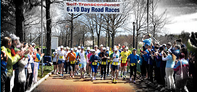
Background: Years ago, when I first started to dabble in triathlon, I heard of a race around the Thredbo and Jindabyne area and thought I would prefer that to the more clinical road based events. I think it was run only once or twice though and I had to wait until this event was staged to have an opportunity to test myself in a longer off-road event as a soloist.

In the meantime I gained a wife, mortgage, two kids and a bigger workload at the office. Having read winner Jody Zerbst's 2005 race report, I thought my story, told from the position of tail end of the field of the 2006 race, might balance the perspective. Lead up I only entered the event on the cut-off date as I was really unsure if I could finish and didn't want to look like a basket case on the day. I rang Prachar who said some of the individuals would be slow and even some of the teams were really not serious athletes and I should be fine.


I found out at registration that there would be only three solo open males, one woman and one 50+ male. This was well down last year 20+ solos and made me wonder why people weren't backing up again this year. It meant I could stand on the podium for the first time in my life if I finished.

Preparation
Having done an Ironman race 12 years ago, I knew a nutrition plan would be wise but I just never got around to it. I never found the time to test different foods on training days. The other shortcoming was not training with any form of electrolyte drink. On race day I set up one hydration backpack for the kayak with Gatorade and one for the run/bike with water and with a standby supply of gels and bars. Also made up some jam and peanut butter sandwiches the night before. A spare tube and tool kit would be added to the backpack for the bike legs.

Swim 1
All solo competitors met and shook hands before the race started. This felt strange, but as there were only 5 all up it made sense. The five soloists had roughly a 10 minute head start. The sun had yet to crest the hill East of Jindabyne, but the first marker was visible off in the distance. The water felt warm enough in my wetsuit that had not been used in two years. It was an uneventful casual swim for me, unlike that of the two team swimmers who came steaming past me near the finish, who were competing for the win and did a
18:30 for the 1.5k. Warning lightswhen on when my calves cramped getting wetsuit off.

Paddle 1
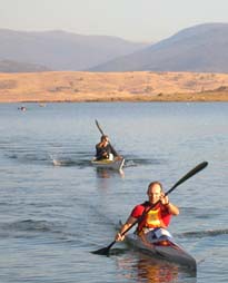
Afterwards my helper Adam commented that he thought I looked drunk as I struggled to get positioned into my kayak. I then proceeded to carve a semi circle with the rudder stuck in full right lock. Once these things were sorted I headed out into tranquil waters in what was the easiest leg of the day. Actually able to overtake a couple of people as well as being overtaken myself. Drink a bit of Gatorade. When Buzz from Cruising Studs came past at about halfway I was able to sit on her wake for 5-10 min and use her as a gauge until a decision had to be made about going around a sand spit or to portage. The portage looked more popular and direct (no faster in the end). No chair or towel or real transition planning meant wiping my sandy feet off on my running shirt. Ate a banana and headed out.
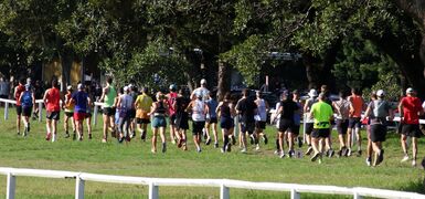
Run 1
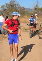
Conditions were great for running. With a single digit race number on my back (#2) I started to receive encouragement from other competitors, a trend that really did make a difference throughout the day. Managed to overtake one team person and was overtaken by half a dozen. The course was hillier than I thought it would be and running past the finish to do the extra loop down along the lakeshore was dispiriting. Drank water and had an energy bar.

Ride 1
Having ridden this section in January, I thought a bike with more travel would be quicker over the more technical sections. The Kona Stinky felt a bit heavy riding up the first hill, but I tried to have a bit of fun with a couple the little ramps and ledges on the course. Had a banana and 1.5 gels, with .5 of one ending 
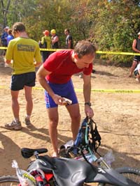
up all over brake lever. Overtook two team riders but was overtaken by half a dozen, many of which had encouraging comments to give. Again transitioned in dirt, tried to choke down a jam sandwich and only managed a few bites. Not really hungry- more like a bit queasy.

Swim 2
Ran the 200 metres barefoot to the water edge and noticed people coming down to collect their swimmer's shoes and thought gee that was good thinking. I forgot to zip my wettie and was helped by the wife of another soloist who had just departed. I had meant to buy some new goggles in the weeks leading up to the race and never got around to it. My 2yr had taken the clips off mine- meaning I had to tie them together. Leaking goggles meant stopping to clear the water out every 5 minutes. Started to experience toe cramps, and my arms and felt cold even though the water was warm enough. Strange. Tried to relax legs as much as possible and cramps went away. Once on shore the shivers and chattering teeth started. Try to eat sandwich- manage a few bites before it falls in the dirt. A woman waiting for her team's swimmer to come in said it was OK and that"Egyptians teeth were ground down from eating so much sand". Crowds noticeably smaller now.

Paddle 2
I count 5 swimmers behind me as I began the paddle, which was uneventful with smooth conditions. Look longingly at the water skiers and thinking that might be a more fun thing to do today. Able to drink a bit of Gatorade. Get overtaken by two kayaks and a ski. Not sure where to go? I can see the flash of sunlight off paddles in the distance. Some seem to be heading right, some left. Eventually I can see people veering more left to what I am told later is a slightly different transition point from the year before. This lake is hard to navigate as the foreshore is all sand and boulders without much in the way of landmarks. Adam has set up 100m away from finish chute and scrambles over with the bike and other gear when I ask nicely upon approach to"bring the #@*# over here".
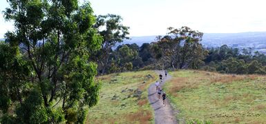
Ride 2
This ride was supposed to be about 25 minutes according to people who had done it before. The first few hundred meters of sand at the start seemed to be eating big chunks out of this time for me, particularly after a minor stack in the soft stuff. I look back up the paddle course and think I make it four paddlers still coming in. This leg is on private property and I had not attempted it in practice. It was marked well however, and easy to follow. Overtaken by one rider just as I started to talk to the cows on the track. Understood better what it was to have a"tough hide" when riding up the cow track through waist high thistles that mustn't worry the cows but were annoying my skinny little legs.

Run 2
Had a cup of coke, a top up of water bladder, a banana, and a smear of Vaseline under the armpits before heading down to the
Thredbo River. Ihad walked a couple of the switchbacks when running this track in practice and fully intended on doing the same today. Legs feel fine, but pulse seems too high for the effort and end up walking every hill section. Energy starting to flag. Low point of the day, feeling dehydrated and nauseous and getting cramps in my jaw of all places. Overtaken by two team runners, the second points out a red bellied black snake and we chat for awhile waiting for it to cross the track. He is complaining about cramps but I am just wishing I could eat something substantial. My practice of this run leg took 40min up to Sawpit Creek and 36min for the loop. Today I was at over an hour and counting and was still looking for the transition. Once there, at first I wonder why nobody is in compound and then remember it has moved down the road. Luckily there is a water stop so I fill my bladder and head up the 6k loop. Overtaken by two more team runners. The loop takes :50, not :36 when I jogged it before. Have a couple of cups of warm tropical Pepsi and speak to wife on phone."Yes, taking it easy, yes, will pull out if I feel sick. Don't worry so much. It is almost over anyway"

Ride 3
The night before the race I saw an interview with a Commonwealth Games swimmer who repeated her mantra"focus on the process, not the results". I was at a point in the race (8 hrs) where to finish, I couldn't think of how much still had to be done and adopted this for myself. This ride was therefore broken down into the climb, the descent, and the undulations. I met the hastily derived goal to never stop turning over the legs on the climb, enjoyed the descent on the bitumen and really felt through the shoulders the descent on the corrugated section. Overtaken by the last team rider. I was now on my own. Tried to ride in a very conservative way in case I end up injured down an embankment. Had to push up a few of the hills. Near the end of the track, the sweep came up behind me, stopped, and took a few photos.

Swim 3
As I donned my wetsuit, two team swimmers were about to come out of water, but only a handful of people around. One of the volunteers fed me some seaweed in little packets and Endura, saying it was much better than Gatorade. Decide to break the swim down to 1 marker at a time. Get toe cramps between 1st and 2nd markers (ignore). Hamstring cramps at 2nd marker I can't ignore and need to hang on to second marker's ropes as Adam spins around the Kayak and paddles closer for the rest of the swim. Need to hang on to kayak twice more with cramps.

Paddle 3
Thankful for the decision to bring a slower plastic sit on kayak for this leg. During the practice paddle of this leg in January I learned that the wind and waves were more than my limited paddling experience could handle in a tippy fast kayak. The downside of this craft was that it was heavy and slow. I looked over to the SES boat who was shadowing me to see spray flying off its bow. It was a full on headwind. The distant
East Jindabyne is not gettingcloser. Shoreline not changing. Use an anchored fishing boat as a beacon, who as I pass asks"bout time we head in don't you think". Yes, that is what I have been trying to do for the last hour. I start to wonder if the organisers will pull the pin on my day, can't remember what the cut off times were. Getting dark and I start to feel the cold. The waves coming over the bow warm me up momentarily, but then the wind cuts deeper after each drenching. These are the times that set up the situation I think people get into endurance racing. This is the pointy end of the day that one must struggle with the temptation to quit and to overcome the"why am I doing this?" type questions. The answer today is"because you started and besides, it would be embarrassing to ask the SES guys to give you a lift to the finish". Manage to drink quite a bit of Gatorade but my newly acquired seaweed packets are floating, bloated, in the footrest of the kayak. To fearful to stop (even for 5 sec) paddling for the entire journey, lest the wind blow me backwards. Finally round a point and the wind and waves start to subside. The SES guys motor up and point me to the right bay, and then ring somebody on their mobile to find out precisely where to go. I see a dunny being driven away on a trailer and figure I must be close.

Run 3
Shivering and with teeth chattering, I put on some dry clothes and start to walk to the finish as volunteer Nigel helps Adam put the kayak on the roof. I am told that one of the other soloists have pulled out with cramps. All I need to do is finish for 2nd place. It is now dark, though I can see the orange ribbons for the track. Nigel catches up and we start to run towards the finish. It is a level run and we seem to be going at a good pace. Glad to have him there to talk to and find our way through the campground. Legs still feel fine on the flat and seems like we reach town in no time. The finish is anti-climatic as there are only about 8 people there, most of which are volunteers eager to pack up. I am handed a trophy as I cross the line, walk a few strides to the car, chuck my things in and leave.

Mark Davis

View full article »

Sri Chinmoy Yerrabi/Mulligans Flat Long-Course Maps and Descriptions

By Prachar Stegemann
25 April


The Long Course starts and finishes with a 4 km run - one full loop of the delightful Yerrabi Pond. Start and finish at the compound in Yerrabi Pond District Park. Head south west on the cycle path and continue in a clockwise direction. Do not cross on the pedestrian bridge over the little island, but continue all the way to the far eastern end of the pond, and back to the start/finish compound. After the first leg, transition to the paddle leg.


The second leg of the Long Course is two loops of the route shown above. Starting from the left hand side of the wooden pontoon, head out to the first buoy and turn left towards the dam wall, then follow the course in a clockwise direction, passing to the left hand side of the little island heading out, then to the right hand side on the return. Continue for two laps of the same course. Upon exiting the water, bring your paddle craft to the paddle compound and transition to the mountain bike.

The third leg of the Short Course is a cruisy 28 kms on the mountain bike. From the compound, first head south west and follow the cycle path around the pond. Turn left (north) off the cycle path to pass under Horse Park Dr next to the storm water channel.  Continue on this bitumen cycle path through the new suburb of Forde, until you come to a gate leading into Mulligans Flat Nature Reserve.  Climb this gate and continue over grassland to another larger gate.  Enter through this gate into the reserve proper, and turn left onto the main trail which you follow with a fenceline on your left. Ignore the first potential right hand turn but then turn almost immediately right onto a main dirt road. Follow this mostly flat and fast track in a large arc.

Continue on this track until you reach the first hill, which brings you up into Goorooyarroo Nature Reserve.

Follow the dirt road through Goorooyarroo Nature Reserve all the way until you reach a dead end, near the intersection of Horse Park Dr and the Federal Highway. Here you simply do a U-turn and head back the same way you came. The riding is flat and fast. Depending on whether there are sheep grazing in the Nature Reserve, you may have to climb a gate or two.

When you re-enter Mulligans Flat, turn left at the first fork.

Follow this track back in a westerly direction, then take the next fork to the left. After a few hundred metres, continue straight ahead to follow the "Bird Walk" signs. Continue on this track until you return to the gate through which you originally entered the Reserve. Climb the gate once more and return to Yerrabi Pond by the same route, heading to your left around beside Yerrabi Pond to the finish. Transition to the final run (see above).


View full article »

Sri Chinmoy Yerrabi/Mulligans Flat Short-Course Maps and Descriptions

By Prachar Stegemann
25 April


The Short Course starts with a 2.5 km run. From the compound at Yerrabi Pond District Park, head north on the cycle path beside the pond. Turn left across the pedestrian bridge that links the little island to the 'mainland.' At the far shore, turn right and continue on the cycle path all the way around and back to the starting point. Then transition to the paddle course.


The second leg of the Short Course is one loop of the route shown above. Starting from the left hand side of the wooden pontoon, head out to the first buoy and turn left towards the dam wall, then follow the course in a clockwise direction, passing to the left hand side of the little island on the way out, then to the right hand side on the return. Upon exiting the water, bring your paddle craft to the paddle compound and transition to the mountain bike.


The third leg of the Short Course is 14 kms on the mountain bike. From the compound, first head south west and follow the cycle path around the pond. Turn left (north) off the cycle path to pass under Horse Park Dr next to the storm water channel.  Continue on this bitumen cycle path through the new suburb of Forde, until you come to a gate leading into Mulligans Flat Nature Reserve.  Climb this gate and continue over grassland to another larger gate.  Enter through this gate into the reserve proper, and turn left onto the main trail which you follow with a fenceline on your left. Ignore the first potential right hand turn but then turn almost immediately right onto a main dirt road. Follow this mostly flat and fast track in a large arc. Eventually you will make a hairpin right hand turn where the southern track joins with your track.

Follow this track back in a westerly direction, then take the next fork to the left. After a few hundred metres, continue straight ahead to follow the "Bird Walk" signs. Continue on this track until you return to the gate through which you originally entered the Reserve. Climb the gate once more and return to Yerrabi Pond by the same route, heading to your left around beside Yerrabi Pond to the finish. Transition to the final run.


After the mountain bike leg, the final run course heads south-west and follows the cycle path around the western and northern shores of Yerrabi Pond. Turn right across the pedestrian bridge that links the little island with the 'mainland.' Then turn right again and head to the finish.

View full article »

Leg 8 – 24km Mountain Bike

By Prachar Stegemann
24 April

View and download the full course on Garmin Connect, or download the gpx file. Enjoy a GoPro tour of the entire course, as ridden by Andrew ÖBerg.

The third and final mountain bike leg starts on the grassed space between KFC and the Tuggeranong Arts Centre on Reed St, Tuggeranong. Stay on the pedestrian path beside the lake and go under Soward Way. Continue following this path keeping the lake on your left and take the first left leading to the bridge crossing the creek. Turn left again at the pedestrian bridge (part of the Canberra Centenary Trail) and cross to the other side. Veer right at the other side, proceeding under Drakeford Dr, at which point the concrete becomes a regular bitumen cycle path heading to the right, then veering to the left past Isabella Pond.


Stay to the left at the next fork - never cross the storm water channel (Tuggeranong Creek), which you keep always to your right. After passing under Isabella Dr, follow the cycle path to the right beside a little dead-end road, continuing alongside the storm water channel. The path leads under Ashley Dr before passing back under Isabella Dr. Ignore the concrete paths heading off in various directions, but stay to the left at the one genuine fork in the cycle path. Continue under Weinholt St, then Kellett St before entering Fadden Pines.

Veer right at the first fork amidst the pines, heading over a small bridge. Follow this path straight past the rain garden feature, near Fadden Pines park (on your left). Soon after, turn left off the cycle path at the next concrete path, which leads past a tennis court complex on your right, then under Coyne St into Macarthur, and straight ahead. Follow this path under the power lines, before turning at the 4th path on your left, coming out at the end of Dennys Pl. At the top of Dennys Pl, cross over Jackie Howe Cres, and continue straight onto the dirt track up the other side, past houses on your right. Go right at the fork in this rough track, past a peculiarly shaped storage tank and yellow day-care centre on your left.

Look for a gate to climb on your right, onto a track heading up the ridge, becoming quite steep and rocky in parts. This ridge ends in a saddle, where you turn left onto a faint track beside a fence heading uphill. Continue along the ridge of Mt Wanniassa to a trig station, offering unparalleled vistas of the whole of Tuggeranong Valley and the Brindabellas.

Take care as the descent becomes very steep to the next saddle, where you turn right onto a walking trail, dipping towards a small dam. Go to the left of this dam, then head for the tunnel underneath Erindale Dr. Cross through the wooden fence opening at the "Equestrian Trail" sign and through the tunnel. After the tunnel, continue straight ahead. Round a small dam on your left, then immediately take a right hand fork to follow the smaller power lines up Farrer Ridge. Follow this track ahead even when the power lines dip to the left. When you reach the next fence, climb over and go immediately left over a mini causeway, then left onto the main track, with the fenceline to your left. Do not take the more obscure track forking to the right, as Mt Taylor appears ahead, and the track dips. Turn to the right at the large reservoir on your left, heading up and back around the rear of Farrer. Go left at the T-junction, following the power lines with the houses of Farrer on your left.

After this track smooths and flattens out, take the first right into the bush up a rocky sidetrack, then right again at a fork. At the fence, go through the wooden opening, then turn immediately right at the main track, through the tunnel to pass back under Erindale / Yamba Dr.

At to bottom of the hill turn left onto the tarmac path, then as the path sweeps right turn harder right against the reserve.  In 50m on your right is a concrete / bluestone spill way - on the far side of it, turn right onto singletrack up into the pines - take the right-hand singletrack uphill (The Spine Link - not signed.  The left hand trail is DH only.)  Once you reach the firetrail, turn left along (rather than crossing) the firetrail for 30m then veer right up onto The Spine trail, marked with an Orange-Red sign.  Follow The Spine all the way to the end, turning right / uphill on the tarmac road.  The tarmac gives way to dirt, and at the next intersection take the left hand dirt road.  At the next intersection turn left onto the next firetrail,  up Isaacs Ridge with the Pines on your left.
 
After climbing a little more, a quarry appears on your right, with panoramic views towards Fyshwick and Queanbeyan beyond. Passing another radio tower, take the right hand fork to pass close to Sheaffe Trig. With the whole of Woden stretched below, the track starts to dip, before switching back to the left and diving into a very steep descent. Go right at the first fork, then right again onto the main walking track.


Enjoy some flat pedalling with the houses of Isaacs and O'Malley to your left. The track begins to dip, with the East O'Malley below you. Before you reach the water reservoir, turn right to follow the Centenary Trail, for about 500m of steady descent though woodland. Follow the Centenary Trail downhill heading NE and through a marshy area, then this trail becomes a lovely single track winding through the forest at the southern end of the O'Malley Bushland, and out again into a more open area. Turn left off the Centenary Trail opposite the next CT marker post, onto a wide 4WD track, heading downhill for about 700m (do not take any side tracks) and bringing you eventually to a metal gate, which you pass through to arrive at a concrete footpath, opposite house number 10 and 12 (with a flag pole). Turn right onto this footpath, which after about 80, turns left, following Keyar St. After another 100m the footpath turns right. Follow this path around the left hand side of the playground, staying always off the road, and look for a turn to your right, through another gate, then up and over a steep dirt embankment, and down into the long pipe under this Hindmarsh Drive, turning to the right as you emerge at the next transition compound.


mtb-3-profile.png


<Previous | Next> Back to Contents

View full article »

Leg 6 – 11km Run

By Prachar Stegemann
24 April

View and download the full course on Garmin Connect, or download the gpx file.

The second run starts from the grassed area on Badimara St, Waramanga, follows the cycle path under Tuggeranong Parkway, then turns immediately right onto Waldock St, heading uphill towards Mt Taylor. Before reaching the car park, the course departs the road through a gap next to a gate on the right, onto a graded dirt track to the left. Follow this track up a very sharp incline, the steepest climb of all the run courses. Near the summit, veer left onto a small track to touch the trig station, and pause to appreciate a drink and the very best views of South Canberra and the Brindabellas. The trail down the southern face of Mt Taylor offers further scenic rewards, with striking vistas of Tuggeranong Valley and the lake, which is the destination of this run. Near the base of the mountain, the trail comes to a T-junction with a graded track. Turn right here (toward the Brindabellas), and take the next right hand fork, hugging the mountain. After a few small roller-coaster hills, take the next fork to the left under the power lines, heading down rather than up, then left again onto a small track, where there is a drain covered by a large metal grating on the right.

After the gate, turn sharp right onto a small single-lane track (ie do not head across Sulwood Dr). Follow this inconspicuous track across Colquhoun St, then turn left onto the cycle path, passing immediately underneath Sulwood Dr, and later under Marconi Cres. Just before some playing fields, take a left fork in the path, then right at another fork between two playing fields.

You will head under the dual carriageway of Drakeford Dr, twice under O'Halloran Cirt, then under Athllon Dr, before making a LEFT turn onto the cycle path beside Lake Tuggeranong. Follow this path around until you reach Nguru Beach, where you will follow the cones across the grass to the transition to the final swim leg.


<Previous | Next> Back to Contents

View full article »

Leg 1 – 1.5km Swim

By Prachar Stegemann
21 April


Enter Lake Ginninderra from Dulwa Beach, at the western end of Diddams Close, near the boat ramp. First head south, towards Belconnen Town Centre. Keep all buoys to your left shoulder. The swim finishes at the transition by the playground, at Bimbi Beach, at the eastern end of Diddams Close Park.


<Previous | Next>

View full article »

Leg 7 – 1.2km Swim

By Prachar Stegemann
21 April


The 3rd swim leg (leg 7), will commence from Nguru Beach, off Mortimer Lewis Drive. The transition from Run 2 to Swim 3 will be at Nguru Beach. Swim straight out from Nguru Beach, then turn left to follow a straight line heading south down the middle of Lake Tuggeranong, and the finishling location (and transition to the 3rd mountain bike, leg 8), behind KFC on Reed St, Tuggeranong.


<Previous | Next> Back to Contents

View full article »

Leg 4 – 3.5km Swim

By Prachar Stegemann
21 April

Enter Lake Burley Griffin from the beach at Grevillea Park, and swim towards Kings Ave Bridge, keeping the marker buoys to your right. Follow the southern shore of the lake through Central Basin. There will be a drink station at the National Library jetty. Pass under Commonwealth Ave Bridge into West Basin, turning to your right around the final marker buoy, to exit up the ramp at Henry Rolland Park.


<Previous | Next> Back to Contents

View full article »

Leg 3 – 18km Run

By Prachar Stegemann
21 April

View and download the full course on Garmin Connect, or download the gpx file.

Cross Antill St and follow the dirt track over the horse logs. Climb over the first stile you come to, onto the Casuarina walking trail leading uphill. Go straight through the next parallel log opening, and continue uphill. Turn left at the T-junction immediately after crossing another stile, onto a 4-wheel drive track. After a hundred metres or so, leave this track to climb yet another stile on your right, leading to the West Face walking trail heading to the left. This track initially climbs quite steeply, then cuts back to the right and follows the side of the mountain until it reaches a saddle, where the course again turns left and uphill, onto a four-wheel drive track concluding at a gate just before the summit of Mt Majura. Cross the bitumen road and scramble up to the trig station. This is highest point in Canberra, and in the Sri Chinmoy Triple-Triathlon. Enjoy a well-earned drink.

The course winds with the road half way down the mountain, taking a sudden right hand turn into the bush. Pass through a gate, onto a more obscure trail heading to your left. This trail will bring you to a fenceline, which you then follow, hugging the fence to your left. This will bring you down to a gate.

Over the gate, turn right at the main 4WD track, and then downhill. This track turns left and follow for w ahile and then right onto a smaller track.

Turn right at the next T-junction to remain outside the pine forest, heading uphill (do not enter into the "Auto Alley" single trail unless you want to run much further!)  Follow this track all the way along and above the pine forest, until it eventually merges with another track coming in from the left and below.

Look for the second right hand turn up a long rocky incline through the pine forest, emerging at a cavaletti (horse crossing).

Turn left after this crossing, through the large ditch and onto the walking trail heading up Hackett Hill (above the water tower on your right). Hackett Hill affords lovely views of North Canberra on one side, and across to the airport and Queanbeyan. Coming off Hackett Hill, veer right onto the small trail which brings you onto the main track, where you turn right heading towards the city. Turn left under the power lines, onto "West 132 KV Track" following the power lines around the base of Mt Ainslie.

After a few hundred metres, turn left again onto the "Old Tip Track to Summit", passing around a gate and heading up-up-uphill. Before this track reaches the road, veer right onto a smaller walking trail which mimics the contour of the road until just before the summit.

Cross Mt Ainslie Dr, onto the large traffic island which constitutes the summit of Mt Ainslie. At the beacon, pause briefly to take in the most famous picture-postcard view of the nation's capital, before heading down the stone stairs, across the road and onto the walking trail leading off Mt Ainslie. This trail offers the very best views of North Canberra, Civic, Lake Burley Griffin, Black Mountain and the Brindabellas beyond. Take the left-hand option at the fork near the base of the mountain, cross the main track and head directly into the Remembrance Nature Park, leading over a small footbridge behind the War Memorial. DUE TO CONSTRUCTION WORKS AROUND THE WAR MEMORIAL – TURN LEFT BEFORE CROSSING TRELOAR CRESCENT AND FOLLOW THE FOOTPATH, THEN THE FAINT TRAIL ALL THE WAY TO THE END OF TRELOAR CRESCENT. CROSS TRELOAR CRESCENT AT ITS INTERSECTION WITH FAIRBAIRN AVENUE, THEN FOLLOW THE FOOTPATH ON THE NORTHERN SIDE OF FAIRBAIRN AVENUE TO THE PEDESTRIAN TRAFFIC LIGHTS, WHERE YOU CROSS FAIRBAIRN AVENUE AND CONTINUE.

Take extra care crossing Fairbairn Ave at the traffic lights, then pass to the right of the monument, and follow the footpath down Anzac Parade. Turn left at Constitution Ave. Cross Constitution Avenue here, then turn left along the footpath until you reach Wendouree Drive, where you turn right. Follow Wendouree Dr under Parkes Way, then head straight across the grass and turn left at the main pathway.

Follow this pathway past the carillon on your right, under Kings Avenue Bridge, and then turn right off this path onto the lakeside trail to bring you onto Grevillea Park Beach and the transition point to the next swim leg.

sri-chinmoy-triple-tri-run1-elevation.png

<Previous | Next> Back to Contents

View full article »

2007: Snow Country Legends Team Report

By Prachar Stegemann
1 April

Šri Činmojevo spontano poimanje neograničenog potencijala koji leži unutar svakog od nas navelo ga je da izume sportske poduhvate izdržljivosti koji su se drugima činili kao da premašuju granice ljudskih mogućnosti. Najupečatljiviji primer je, svakako, Trka Samoprevazilaženja na 3100 Milja (približno 5000km) koja se od 1997. godine redovno održava u Njujorku i još uvek je najduža setifikovana drumska trka na svetu.

by the Snow Country Legends team

The day dawned and we headed out from the Snow Country Ski Lodge in Jindabyne, hang on....it was pitch black and 7 degrees as we set off for Kalkite and still dark when we reached the boat ramp where as our swimmer Laurie observed"theres no point starting I cant see any of the buoys"

Finally the sun came up and the swimmers took to the water it was a perfect start to the day no wind clear skies and from all accounts warm waters. Laurie comfortably cruised through the swim leaving many younger competitors in his wake.....Laurie is 67!

The start of the paddle had its moments as the shoreline was knee deep in mud giving some of the paddlers a slow start. Rob our paddler got a boot full of mud and came straight off the ski lost his boots in the mud and paddled off regardless.

The paddle down the lake was eerie as the water level is so low that the course was littered with branches of long dead trees, sandbars and half-submerged rocks. The paddle did have its problems with a nasty crosswind at times giving several kayak paddlers trouble on the way down and a long swim for at least one unlucky paddler!

The change over to John C our runner went without hitch except for more bootfulls of mud and off he went for a challenging run, more challenging because John doesn't have great eyesight and we were worried about his navigation around the off road course. But a close reconnoiter of the course the previous day and the necessary help along the way from other runners got him safely home.

John C handed over to Daniel our intrepid bike rider who had heard about the bike course but had not had time to go over it the day before. Just as well because he had a nerve racking time taking a spill but still powering his way round a very tricky course without losing too much bark!

None too soon Daniel handed over to John K our long course swimmer who by this time was well warmed up and he headed out into the clear blue waters of the lake with a long even stroke. At the end of the swim course at Stinky bay we were awaiting his arrival trying to guess his stroke but with no luck most of us were sure we had John picked out until she emerged from the water!!

A strong swim from John K put us in good stead for the paddle and Jill our paddler headed out into the lake with no trouble. Jill had been dreading choppy conditions on the lake but the day was kind and the paddle was flat and calm although getting off a ski and running up the chute to hand over was more of a challenge.

Rob our bike rider set off and it was a rather sandy start to the leg which is always treacherous for bike riders but once through this the bike was underway with plenty of time to take in the sights including cattle on the course and several fences to jump. One such fence had a step up on one side but no step down so with bike on shoulder the rider had to jump down! No sooner had Rob surmounted a very steep grassy slope then the course ended rather abruptly and our runner Daniel took off up the mountain.

Now this is the same Daniel that had not had time to check out the first bike course so naturally he did not know the run course either. We waited and waited and waited up at Sawpit and finally Daniel did finish but with tales of a very tough time out there and an average heart rate of over 180!! Are we glad that Daniel volunteered for this leg.

Equally challenging was the last bike leg and John K our rider though very experienced had to use all his skills (even walking up hill) to conquer the course. When he finally emerged on the beach at Creel Bay it was with some relief to all. But a strong bike time had really set up a good finish for our team.

Rob our swimmer had been so bored waiting for John K to finish and he was so pleased to get into the water that he powered off on the swim forgetting that he had already covered two legs. It wasn't until in sight of the finish that the fatigue really hit in but he was too close to slow down so he thrashed on to hand over to the intrepid Daniel who had been nominated as the final paddler only days before the event.

After a hair raising bike ride and a gut busting run it must have been pleasant for Daniel to have a flat water paddle to take on however the wind came up and gave him a bracing headwind all the way down the course. He finished with a strong paddle to hand over to our final runner Kerrie who took off down the course eager to get to the finish line.

Despite some stray runners on the track she finished well so well in fact that as Kerrie powered through the finish line she was handed a trophy by Prachar Stegemann. Yes the team had done well enough on the day to receive the 2nd team of 12 trophy!

Congratulations to all who took part particularly the single competitors....awesome! Thanks to our manager/ handler Marissa who did a great job organising us all and finally thanks to the Sri Chinmoy organisation that put on a great event and organised wonderful weather for the day. It was our first race and we will be back!


Oh and the shirts everybody admired our race shirts on the day and they were donated by George from the Sutherland Leisure Centre in Sydney where we are all members. Thanks George!

View full article »

2007: Report from the Go Go Girls 50+

By Prachar Stegemann
26 March

The 18 seconds chase (Special thanks to all the female teams of four)

Third time proves it!
And we are sort of fit.
Are we going for gold?
It's not about winning,
we use it for thinning,
and besides that, we're OLD.

With 12 legs to complete,
An incredible feat,
With only four lasses:
A fish, a kayak, a bike and two fast feet.
And additional years - two hundred we beat!
Lets hope for no crashes.

The weather is kind (third year in a row)
Despite claims of"I'm slow"
Helen's out of the lake in a flicker,
Jean's off - with cadence that's quicker
She lands at the Bay
But to her dismay
Runner Sue is no where to be seen!

Frantic searches and phone calls
Could there have been falls?
No, a timing glitch caused the gaps.
A watch wrongly set
(We've sent it to Phuket)
So it can't give us any more mishaps.

Many minutes, maybe more
We lost on that shore.
Femme Salu now off in the distance.
But Sue's in pursuit
She worked hard on the loop
At run/bike we're trailing seven minutes.

For our next little glitch.
When it came to the switch,
Peg's bike got bogged in the sand.
Helen's toe was gashed
With the cluster she clashed
But swam like fury as planned.

The mud at transition
will not stop our mission.
And no squelchy black goo
can slow Jean's canoe,
Peg's ride or speedy Sue.


The next goal is Sawpit
This runner's so fit
Up Pallaibo Track she flew.
No sweat on her brow
“Here comes Sue now"
Only 3 minutes behind the Salu.

Peg heads for Horseshoe
On a route that is new
Towards Kalkite Hill she strains.
The Vixens pursue and pass us (it's true)
We're now third at the Botherum Plains

Peg flew over deep ruts
With gumption and guts
As our gold medals were turning to brass
Her ride at an end
Three legs left to contend
With only minutes between the girls class.

Hel's off the blocks
To chase down the fox
And passes before the first buoy.
But the slippery Salu
Swim faster than you .
But still a paddle and run to enjoy.

It's the last paddle leg
So off Jean sped
In hot pursuit down the lake.
Gaining and gaining
(with a fair bit of straining)
A minute and a bit it will take.

Sue tagged the canoe
And ran out of the goo
As fast as her mind-body allowed
It was ever so close
Eighteen seconds at most
But we enjoyed it and felt rather proud.

(Thanks to Sri Chinmoy for organising a great event and thanks to the Femme Salu and Velocity Vixens for a great race. See you next year - with a new watch!!).

View full article »
  • ‹ previous
  • 3 of 4
  • next ›
More articles under Sri Chinmoy Marathon Team articles »

Sri Chinmoy Marathon Team articles

main page »

Stories from around the world

United Kingdom
SRI CHINMOY 5K - Scottish Championship 2026
Bulgaria
Ten Runners Reach 1000 km (620 miles) at the Recent Sri Chinmoy 10&6 Race in Sofia
Worldwide
First Sub-Two Hour Marathon
United States
3, 6 and 10 Day Race 2026 Results
New Zealand
28th Sri Chinmoy 6-12-24 Hour Track Races - AUT Millennium Stadium, Auckland
Worldwide
Swimming for Peace
3100 Mile Race
Highlights of 3100 Mile Race 2025

About us

  • About the Marathon Team
  • Sri Chinmoy, Team Founder

Our races

  • View all events

Results

  • Previous races
  • Worldwide results
Global homepage »

Country Websites

  • W.Europe
    • Austria
    • Finland
    • France
    • Germany
    • Great Britain
    • Iceland
    • Ireland
    • Italy
    • Netherlands
    • Norway
    • Portugal
    • Switzerland
  • Central & E. Europe
    • Belarus
    • Bulgaria
    • Croatia
    • Czech Republic
    • Hungary
    • Latvia
    • Macedonia
    • Moldova
    • Russia
    • Serbia
    • Slovenia
    • Slovakia
    • Ukraine
  • N. & S. America
    • Brazil
    • Canada
    • Guatemala
    • United States
  • Asia
    • Japan
    • Mongolia
  • Oceania
    • Australia
    • New Zealand

Other sites

  • Sri Chinmoy Cycling Team
  • SCMT Channel Swimming
  • SCMT Climbing
  • 3100 Mile Race

Popular Pages

  • 3100 Mile Race
  • Recent media coverage
  • History 1977-Present
  • Our members
  • Privacy policy
  • Cookie settings
  • Log in

Contact Information

Sri Chinmoy Marathon Team
Brisbane • 87 Pembroke Rd Coorparoo QLD 4151 • 0450 765 315 • Email us
Canberra • Shop G, 1B Dickson Chambers, Dickson ACT 2602 • +61 404 071 327 • Email us
Melbourne • PO Box 3247 Cotham VIC 3101 • 0407 333 740 • Email us
Sydney • Shop G, 1B Dickson Chambers, Dickson ACT 2602 • +61 404 071 327 • Email us
Creative Commons License

Except where explicitly stated otherwise, the contents of this site are licensed under a Creative Commons Attribution-NonCommercial-NoDerivs 3.0 Unported License read more »

SriChinmoyRaces.org is a Vasudeva Server project.