The 3rd mountain bike leg is by far the longest leg of the day, starting with a climb on the road and the highest point on the course, another gruelling climb after crossing the Snowy River and a net descent from top to bottom of 700 metres through the forests adorning the edge of Australia's highest mountain range. Note that cyclists MUST carry their own water or other replacement fluid.
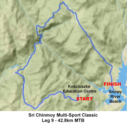 View and download this course on Garmin Connect.
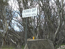
Starting from the Kosciuszko Education Centre on Kosciuszko Rd, turn onto Kosciuszko Road heading solidly uphill for the first 8 kilometres as far as Rennix Gap, at 1600 metres the highest point on the course so far.
400 metres after Rennix Pass, turn right onto the road to Guthega, with about 4 kms of downhill riding, still on bitumen.
Though it is tempting to speed on this section, be extremely alert for cars coming in the opposite direction and DO NOT cross onto the right hand side of the road under any circumstance!
Turn right at the fork towards Island Bend, which leads right into gravel with several options but no signposts. Take the furthest right of these options, heading slightly downhill into the bush. You will pass by two turn-offs to Island Bend Dam on your left. Glide downhill through forest which was completely burned out in the January 2003 bushfires, but has shown remarkable recovery. Continue for about 6 kms on this dirt road, ignoring all turn-offs to your right. The road bends sharply to your left, then you cross the Snowy River (or what is left of it).
Take the trail directly ahead after the bridge and begin climbing, and climbing, and climbing. The following climb is graded about "Push Bike Hill" x 4 ("Push Bike Hill" is the climb up Black Mountain on the first mountain bike leg of the Triple-Tri). After 2.5 kms of climbing, turn hard left at the next fork in the trail, passing around a gate onto the Gungarlin Fire Trail. The next 200 m are the steepest part of the climb.
The climb plateaus briefly half way up before following power lines to the top of the hill (6 kms and 500 m vertical climb from the Snowy River crossing).
This trail continues to undulate downhill through forest, with spectaular views across to the east. After about 2km turn sharply right onto the Botherum Trail, which is signposted but easy to miss as you descend, located 300 m before a bridge crossing over a creek at the bottom of the descent. If you come to this bridge, you have come too far!
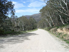
Follow this trail east through the open grass Botherum Plain and over the Gungarlin River, where you may get wet feet. The trail continues past the large boulder on your right known as Kalkite Rock, then up over a small rise and through Kalkite Gap before the descent - 600 m vertical over 7 kms - towards Lake Jindabyne. Take great care, as sections of this descent are deeply rutted.
You are heading directly towards the start of the race at North Kalkite Boat Ramp on the opposite shore. Turn right about 500 m before the lake and follow a faint trail south through mostly open grassland to finish at Snowy River Beach, opposite Waste Point. A ferry service will transport cyclists to Creel Bay and your waiting support crews.
For detailed course descriptions and maps of other legs, select from the list below.

